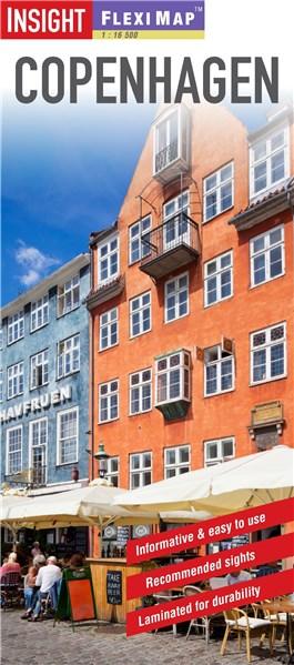
Flexi Map Copenhagen is a laminated, tear-resistant map which has 3 maps, each accompanied by its own index.
It includes a list - with descriptions and some photographs - of 23 recommended sights, divided by theme and linked to the mapping by numbered markers.
There is also a handy information section with concise details on getting around, tourist offices, money, tipping, opening times, public holidays, telecommunications, emergency telephone numbers and climate.
On the main map, shown at a scale of 1:12,500 (1cm = 0.
125km), streets are named and a selection of hotels, public buildings and key sights are prominently marked, pedestrian areas and one-way systems are also shown.
The comprehensive index is divided into categories for ease of use.
A detailed Metro plan is located on the back cover for easy reference.
A Copenhagen area map can be found on the reverse and shows the various routes into the city by road and rail.
Also included is a map of the wider area, shown at a scale of 1:300,000 (1cm =3km).
In addition to the road and rail networks, it provides a picture of the regions topography through the use of relief shading.
Intermediate distance indicators are given on the main routes.


Lonely Planet
50.00 Lei


Helene Le Tac
59.00 Lei